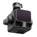
Zenmuse L3 設定ガイド リリースのお知らせ
DJI Zenmuse L3 パラメータ設定のガイドラインをリリースしましたので、ご連絡いたします。ガイドラインは、測量や森林、鉄塔といった...
i-constructionに必用な点群ソフトウエアとUAVを全面サポートします。
DJI Zenmuse L3 パラメータ設定のガイドラインをリリースしましたので、ご連絡いたします。ガイドラインは、測量や森林、鉄塔といった...
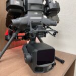
DJI Zenmuse L3の機能や精度検証を実施してみました。性能確認の方法は色々あると思いますが、今回は公共測量の基準で確認しました。 ...

Greenvalley Internationalの LiDAR360/LiDAR360MLS/LipowerLineのバージョンアップ方法...
DJI Terra PPK処理でお伝えしましたように、DJI Terraは、Ver4.5にて、Zenmuse L1(写真のみ)、Zenmus...
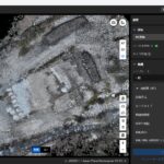
弊社で実際に使用し、測量に必要な基本的な使用方法を全32ページに凝縮。ソフトウエアのインストール、アクティベートから日本のRTKや座標系の図...

RTKファイル指定時のエラー LiDAR360MLSのSLAM処理にて、RTKファイルを指定した時に下記の様にエラーが表示される場合は...
DJI Terraは、Ver4.5にて、Zenmuse L1(写真のみ)、Zenmuse L2(写真のみ)、ZenmuseP1、Mavic3...
Greenvalley InternationalのLiDAR360MLSは、ガウシアンスプラッティング(以後、3DGSと記す)処理を行うモ...
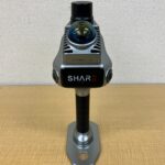
以前の記事「SHARE S20で取得した写真を写真測量に利用する」でご紹介しましたが、SHARE S20は、機械式シャッターかつ、インターバ...
弊社では、ご購入頂いた機材を効率的にスムーズに現場に実践投入できる様に、ハードウエア、ソフトウエアのほとんどの製品において弊社オリジナルのリ...
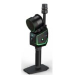
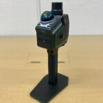
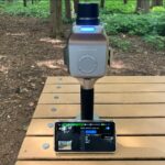
Greenvalley Internationalより新規リリースのフラッグシップハンドヘルド SLAM LiDARスキャナー LiGrip...
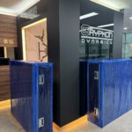
GRYPHON DYNAMICSは、韓国のドローンメーカですが、カーボン素材から開発し肉厚で六角フレームを採用するなど非常に剛性の高い機体を...
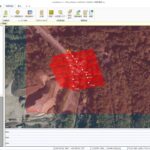
LandStation-Uのサポートからのご紹介です。 お問合せ内容:コース間検証点の解析にて対空標識が認識できません。 ...
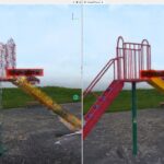
GreenvalleyのO2 Liteで取得した街並みの点群のご紹介になります。プライバシーに反しない範囲でになります。 道路上の線(...
Greenvalley 製品のLiGripシリーズは、SLAMの処理をLiDAR360 MLS BPモジュールを使用して行います。バージョン...
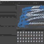
Metashape 2.2.2 の新機能 レーザースキャンデータ処理 レーザースキャンの一致の表示オプション 「マッチング...
一般的にSLAM LiDARは、時間の経過と共にIMUの蓄積誤差が発生する為、製品によっては測定時間の上限が決められていたり、測定開始時と終...
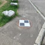
この度、LiDAR SLAM用標識をリリースいたしましたので、お知らせいたします。 LiDAR SLAMは、市街地の中で使用されること...
弊社ホームページでご紹介していますようにSHARE S20は、非常に使いやすくコストパフォーマンスに優れています。購入されたお客様は、ドロー...
2025.10.07 更新 SHARE S20は、機械式シャッターかつ、インターバル設定が最小0.5秒のため、写真測量のツールとしても...